Search results 3 Found
Standard Map of New York (Eastern & Western Section)
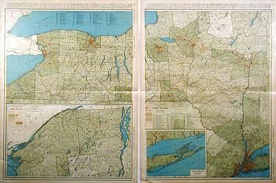
Standard Map of New York (Eastern & Western Section)
Rand McNally and Company
- Date published: 1936
The 1936, sixty-seventh edition of the "Rand McNally Commercial Atlas and Marketing Guide" is unique in its inclusion of informative details concerning population sizes, district uses, the size of counties, and railroad routes. Cities and their populations are listed beside the map. Each map is brightly colored; predominantly in green and tan with blue oceans, lakes and rivers, and brown coloring of high density metropolitan areas. New York State is illustrated on these large, double page maps with an inset of the easternmost part of Long Island on the east section and the northernmost section of the state on with the western section. This two map set is divided into the western and eastern parts of the state. The names of states, counties, important towns, lakes, rivers and mountain ranges are labeled. A list of New York railroad lines is provided. This map measures 19 inches by 26.5 inches.
artsourceinternational-40.00-3e39158e6950d178f374400b872868f0
McNally's 1928 Map of New York (Western Section)
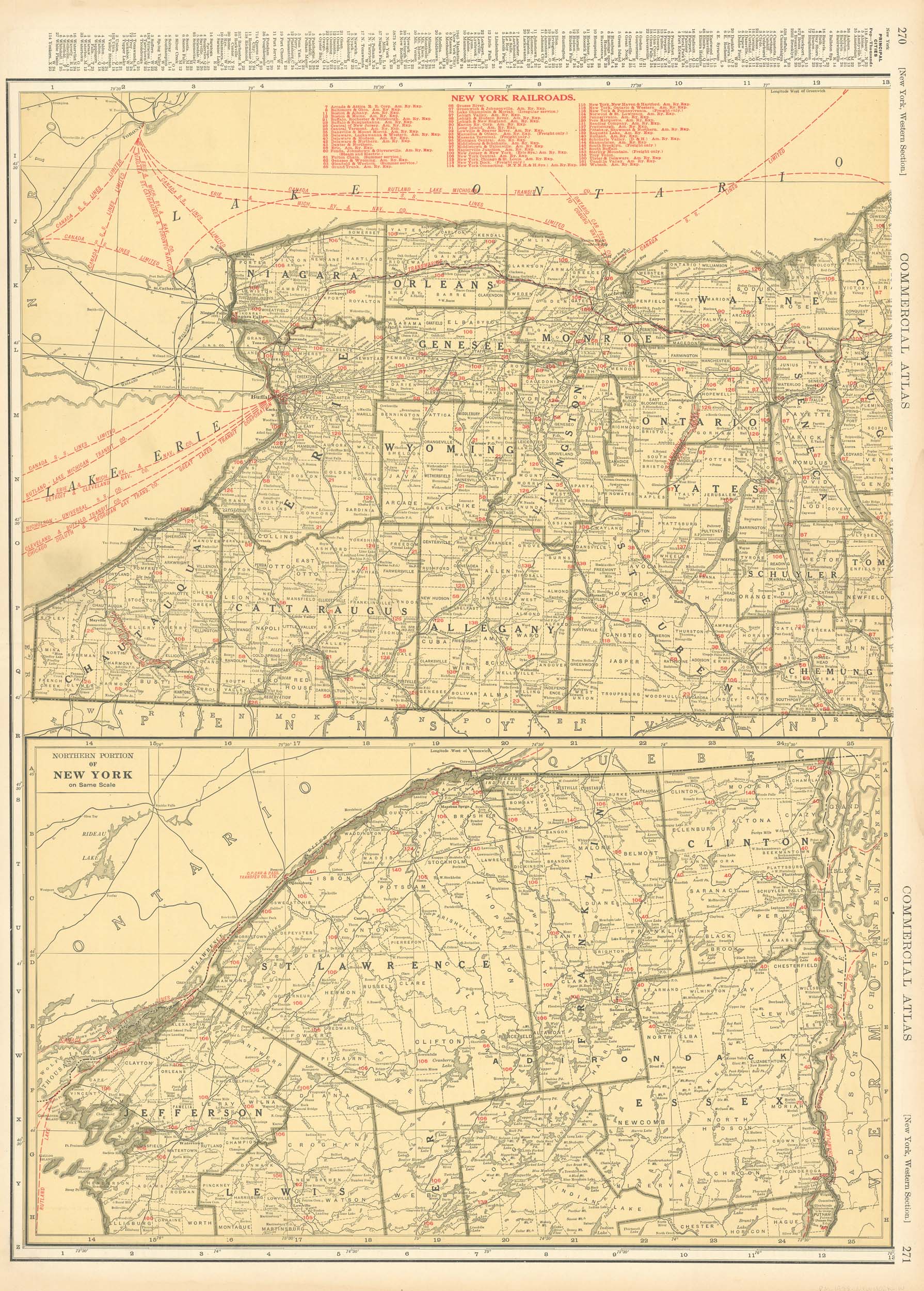
McNally's 1928 Map of New York (Western Section)
Rand McNally and Company
- Date published: 1928
This map was produced by Rand McNally and Co. as part of its 1928 Commercial Atlas of America. These maps are some of our favorite maps because of the large size of each map sheet. The detail shown on each map is exceptional because of the map size. These maps were intended to be used by business for shipping and other uses. Roads, railroads, rivers, and buildings are clearly shown. There is more detail on these maps than any others during this time period. This map measures 28 inches by 20.5 inches.
artsourceinternational-50.00-650c701997c582195779649a53824286
McNally's 1919 Map of New York (Western Section)
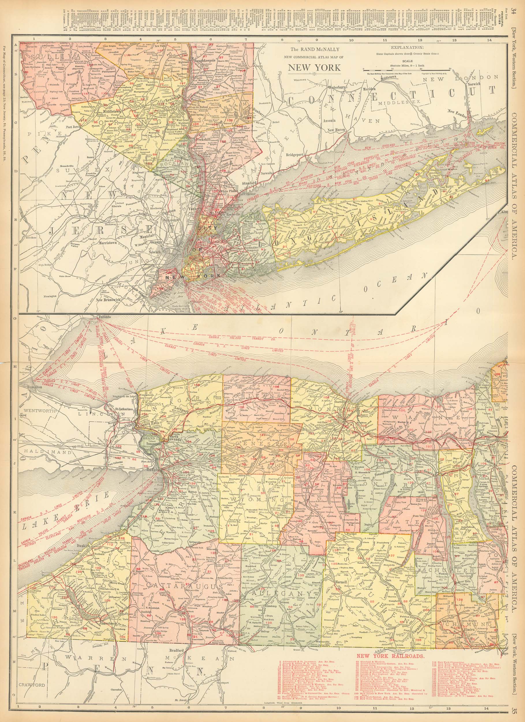
McNally's 1919 Map of New York (Western Section)
Rand, McNally & Co.
- Date published: 1919
We are proud to offer this wonderful large scale map originally issued as part of Rand McNally's Commercial Atlas of America in 1919. The maps from this atlas were larger than most atlas' published at the time and show many more cities and towns. All railroad lines were drawn in red and numbered with a listing of all railroads operating in the area on each map. William H. Rand founded the company in 1856 and incorporated it in 1873 with his partner Andrew McNally. They published their first atlas, The Business Atlas, in 1877. Rand McNally and Company is the oldest business of its kind in the country. This map measures 27 inches by 19.5 inches.
artsourceinternational-60.00-af5ac1e96e3200d17b57c43afe3985aa